Photogrammetry / VFX / Post Processing
Photogrammetry & Survey Services in Dubai, Abu Dhabi, and KSA
-
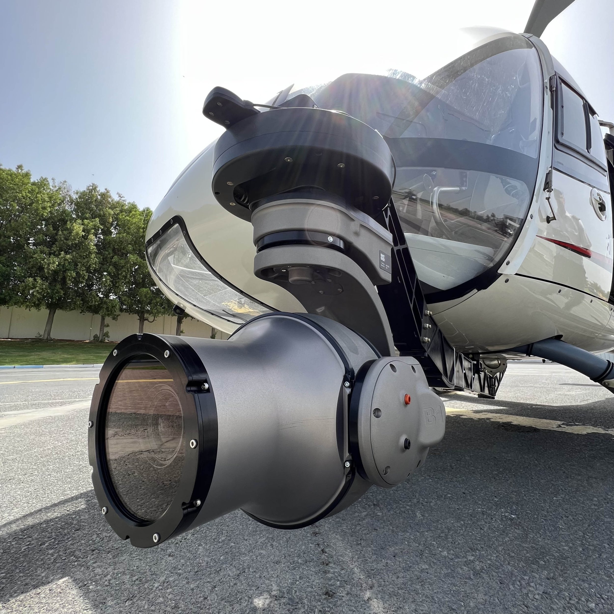
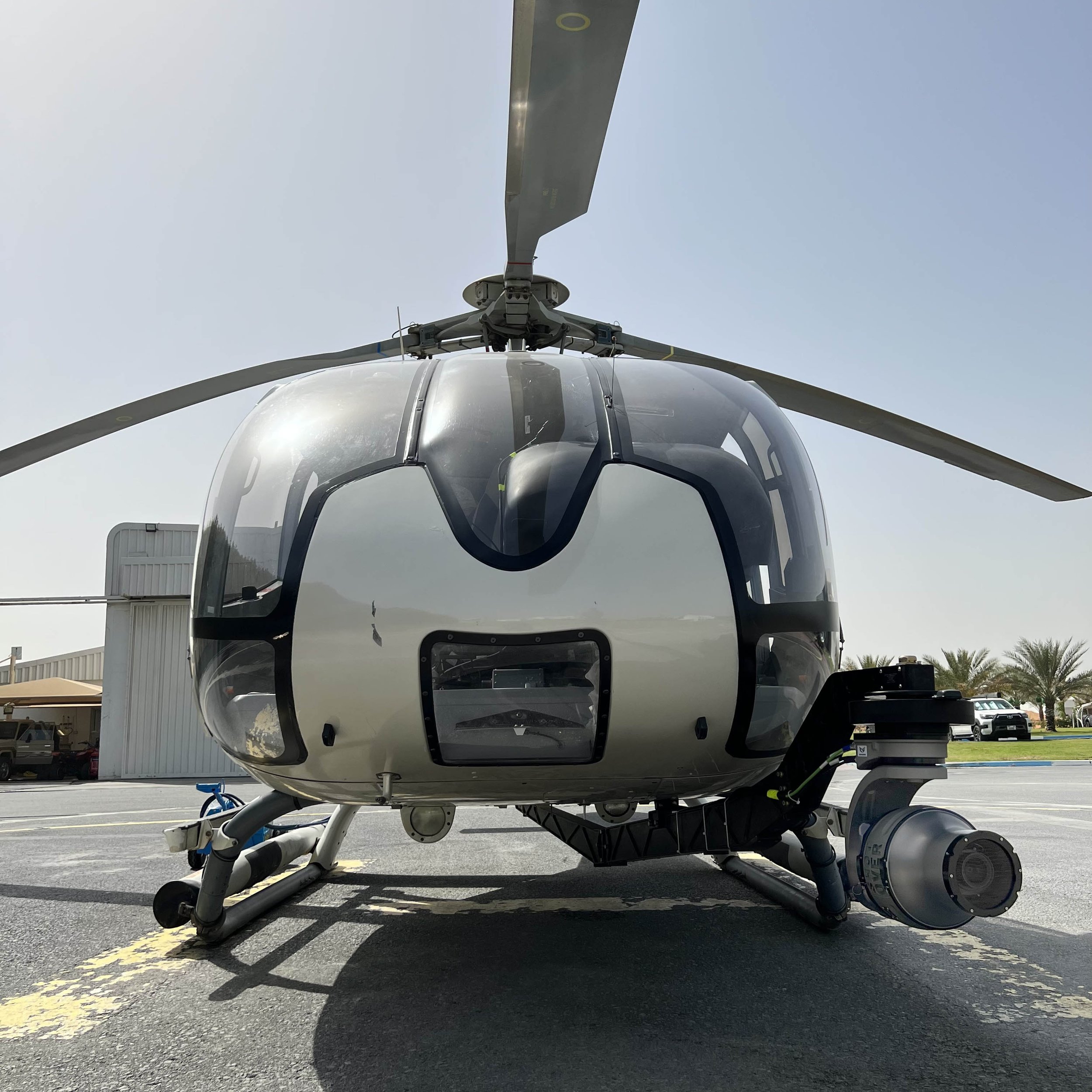
Phase One 100 MP
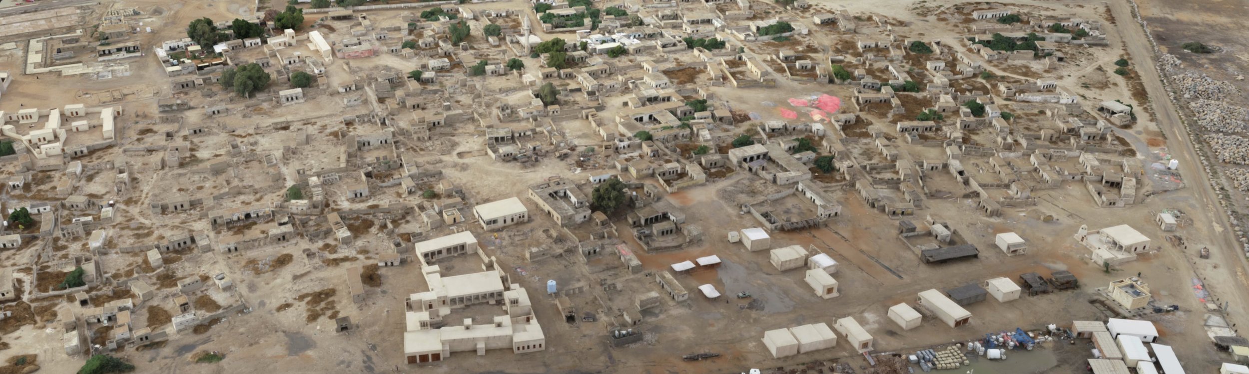
We own the world’s only photogrammetry system with 6 axis gyro-stabilized head with aviotronix flight planning software to fly in the grid to ensure we capture precise overlapped images to create accurate phoogrammetry data.
-

Drone & Fixed Wing
We can provide M300 multirotor drones or fixed-wing unmanned aircraft. We are fully equipped to fly in urban or remote areas based on the regulation requirements. Our Helicopter Phase One system can fly near airports, and built-up areas and our drones can fly in remote locations.
-

Data Post Processing
We have an in-house team to post-process photogrammetry and 3D Modeling Data. We can provide quick turnaround and work 24 hours to deliver any project. We work with Reality Capture, Agisoft, and Bently for all our post-processing projects.

Fulfilling Your Surveying Needs in Days, Not Weeks
We have a specialized section of drone survey and 3D Mapping for construction and the VFX industry, which revolutionizes the landscape of land surveying and mapping services in Dubai, Abu Dhabi, and KSA. With our cutting-edge drone technology, we excel at delivering swift, cost-efficient solutions without compromising on precision or accuracy.
The CHOPPERSHOOT edge doesn't stop there. We're equipped with in-house post-processing capabilities, enhancing our offering to include comprehensive and accurate maps and drawings. Our services are renowned for the most accurate absolute world coordinate positioning and relative measurements, vital for legal and engineering purposes.
Excelling in Photogrammetry and Topographic Mapping
As a leading professional drone survey company, revolutionizes the landscape of land surveying and mapping services in Dubai, Abu Dhabi, and KSA. With our cutting-edge drone technology, we excel at delivering swift, cost-efficient solutions without compromising on precision or accuracy.
From a single parcel to thousands of acres, our seasoned team can provide superior imaging data tailored to your needs. Whether you're an engineer, architect, or land surveyor, we're committed to partnering with you to amplify your services, expedite delivery, and significantly reduce costs.
Our proficiency extends to an array of services, offering you the best drone survey in Dubai and beyond. We specialize in photogrammetry in Dubai, producing high-definition orthomosaic photos for detailed visual inspection and topographic mapping, amongst others.

Meeting Challenges Head-on: Helicopter Survey and Mapping
We understand that drone operations may not be permitted in certain sensitive areas. As an alternative, we offer a robust helicopter survey and mapping solution to circumvent such restrictions.
Our helicopter survey services can be deployed at higher altitudes, equipped with state-of-the-art mapping software and workflows to capture detailed data even in locations close to airports and altitude-sensitive regions.
This flexible, dynamic approach ensures uninterrupted service delivery, allowing us to maintain the top-quality, precise results you've come to expect from CHOPPERSHOOT, irrespective of location or regulatory constraints.
We are committed to meeting your surveying needs with the utmost accuracy and efficiency, whether by drone or helicopter.